
Trace an Eastpointe Street Directory
Start an Eastpointe street search with the property address, not a person’s name. Macomb GIS accepts a property address, tax ID, intersection, or known address. Its map connects the Eastpointe address to a TAX_ID, parcel boundary, community, and legal description. The tax ID is the durable bridge when a street spelling changes or a result is close to a city edge. A map result is a parcel record, not proof that a particular person lives there.
Move from the mapped parcel to the Eastpointe assessor path, then to the deed index. The property card can supply the current owner or additional property detail, while the legal description keeps the later Eastpointe deed search on the same tract. Finish with the relevant Eastpointe dated directory volume when the question is historical. That sequence separates a present parcel fact from an older household lead.
- Enter the full address in Macomb GIS. If it fails, omit the street suffix, select the Eastpointe community, or use the known-address search for an apartment, condominium, or mobile-home unit.
- Open the result, note its TAX_ID and legal description, and use the tax ID to keep the Eastpointe parcel in view while checking nearby polygons.
- Use the Eastpointe BS&A portal for its Assessing Search or Property Sale Search. Its landing page also points to building and request services, although its exact live result fields were not verified.
- Search the current owner as grantee in the Macomb County Register of Deeds index, then read the seller, or grantor, on the transfer instrument and work backward with the legal description.
- For a past household, consult the Eastpointe directory volume closest to the period at issue and use a street or criss-cross section where that volume provides one.
Note: Record the search date and the exact address form because map data, ownership records, and mailing information can change independently.
Search Eastpointe Addresses in GIS
Macomb GIS has two useful Eastpointe address paths. Property Address searches take an address and community. Search All Known Addresses uses the E911 address database and can find apartment, condominium, and mobile-home units. The county user guide says the address-points layer must be on to see those results. When a direct entry does not return a parcel, omitting the suffix is the documented next try.
The result table reports Tax ID, Property Address, and Community, and a Tax ID click zooms to the parcel. Intersection search is useful for orienting an Eastpointe street, but a tax parcel by property address is the better starting point for a tract. The table below preserves the documented controls rather than guessing at a live interface.
| GIS field or control | Input | When to use it | Eastpointe result |
|---|---|---|---|
| Tax Parcels by Property Address | Address and community | Find a mapped Eastpointe property | Eastpointe tax ID, property address, community |
| Tax Parcels by Tax ID | Full or partial tax ID | Return to a known Eastpointe parcel | Eastpointe parcel zoom and linked location |
| Search All Known Addresses | Address, community, optional property name | Try an Eastpointe E911-known unit | Eastpointe address-points result when that layer is on |
| Find Intersection | Street and cross street | Orient along an Eastpointe street | Eastpointe intersection location |
Macomb County’s ArcGIS parcel layer shows the schema behind the parcel approach, including TAX_ID, address, owner, legal description, zoning, and value fields.
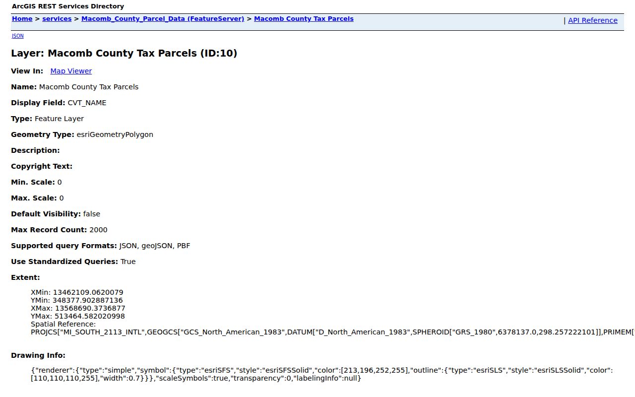
The capture shows why an Eastpointe street directory should begin with a parcel identifier: it ties Eastpointe map geometry to a property record without turning the map into a household list.
Eastpointe Parcel Terms Explained
Three address-related labels have different functions in Eastpointe records. A property address, also called a situs address, identifies where the parcel sits. An owner mailing address is for tax correspondence and may differ. A legal description identifies the land in the language used by the deed. Treating those fields as interchangeable can send a street directory search to the wrong property.
- Parcel
- A mapped Eastpointe unit of land with its own TAX_ID. Nearby homes, corner lots, and vacant tracts can each have separate parcels.
- Situs address
- The Eastpointe street location of the property. It identifies the parcel’s place, not necessarily an owner’s mailing location or every occupant.
- Legal description
- The lot, block, subdivision, or other land description used to distinguish the exact Eastpointe tract in a deed search.
- Criss-cross directory
- An Eastpointe directory arranged by street and house number that can point from an old address to a dated household entry.
Eastpointe GIS visibly lists an address, owner, and legal description in the public parcel schema. It does not promise a separate owner-mailing field. Confirm that field in BS&A or through the Land File route instead of labeling the mapped address as a mailing address.
Compare Eastpointe Street Records
An Eastpointe street directory draws from records keyed in different ways. GIS is strongest for parcel geometry and TAX_ID. BS&A is the city’s property-search route. The Register of Deeds follows instruments and legal descriptions, while city building files can show a dated work or inspection trail. Historical directories add household clues for only the years and volumes that survive.
| Eastpointe address record | Search key | What it can show | Access and caution |
|---|---|---|---|
| Eastpointe Macomb GIS parcel | Address, tax ID, intersection, known address | Eastpointe parcel, situs, community, legal description, owner, zoning, values | Free Eastpointe map; historical cutoff not stated |
| Eastpointe BS&A assessor | Eastpointe address, name, parcel number | Current Eastpointe property record, sales, and possible mailing or exemption fields | Eastpointe portal landing page; exact controls were not verified |
| Eastpointe Register of Deeds trail | Grantor, grantee, legal description, instrument, date | Eastpointe transfers, mortgages, liens, and recording placement | Free index, paid copies, office, and mail channels |
| Eastpointe building and inspection file | Eastpointe address and permit | Eastpointe work and inspection chronology | BS&A links or city FOIA fallback |
| Eastpointe historical directory | Year, municipality, surname, street, house number | Dated Eastpointe address and household clues | Reference-only, gapped local runs |
Use the tax ID and legal description to carry the same Eastpointe parcel from map to assessor and deed research. A street name alone is weak at a boundary or when an older record uses East Detroit or Halfway. The voter system is not a street roster, so it cannot fill that gap.
Note: A current parcel owner and an old directory name each need their own date and source before they can be compared responsibly.
Follow Eastpointe Deed Transfers
The Macomb County Register of Deeds keeps deeds, mortgages, liens, discharges, land contracts, and related land instruments. For an Eastpointe parcel, find the current owner’s purchase as a grantee, identify the seller as grantor, then search that seller as a grantee for the earlier acquisition. When several properties share a party name, compare legal description, lot number, liber and page, or document number.
The county’s recorded-document status notice says its official index may not yet be fully indexed or verified. Search both party roles and test a suspicious Eastpointe gap with the deed image or an office copy. The public page does not give an online cutoff year, so an Eastpointe chain cannot be assumed complete merely because a name search stops.
Macomb’s recorded-document status page specifically recommends a grantor or grantee search before advanced searching. That is a practical check when the same Eastpointe name appears in multiple instrument types.
Price Eastpointe Deed Searches
Macomb provides several deed-search channels, each with a stated cost or access rule. Basic online document search is free, and a basic document purchase costs $6 by credit card. The county advertises advanced address, legal-description, parcel-ID, or name access at $25 for 24 hours, $75 for one week, or $250 for one month. Subscription image rates are listed as $1, $0.75, or $0.50 by tier.
For an Eastpointe street directory search that cannot be completed online, public index terminals at the Register of Deeds are free. Staff search is $5 per search plus $1 per page. Mail search requires a check and self-addressed stamped envelope, with record type, party names, approximate date, and enough property detail to identify the document. The office’s published instructions say mortgage, discharge, and assignment requests need more than an address.
The Register of Deeds search-options page displays the online, terminal, staff, and mail routes used for this Eastpointe deed work.
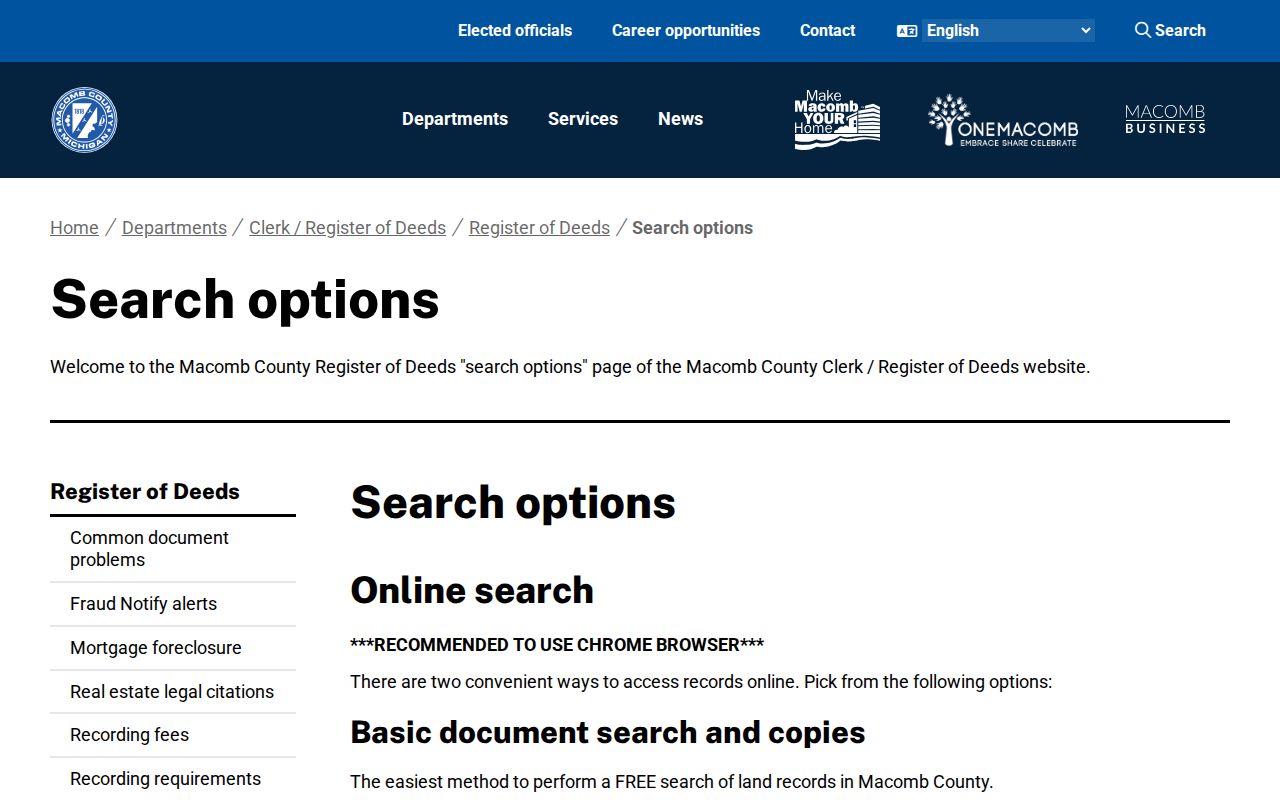
The search-options capture reinforces an important Eastpointe street-search distinction: the free index locates an instrument, while a document image or office copy is the better source for an Eastpointe legal conclusion.
Note: No official online cutoff year is published for the Macomb index, so confirm older deeds through the office, mail search, or archival channels.
Find Eastpointe Permit Files
Address-keyed city records can add a separate Eastpointe timeline for improvements and inspections. The BS&A municipality page links Building Department Record Search, Apply for Permit, Schedule Inspection, Pay Fees, and Create or Look Up Request. A completed public permit record was not verified during research, so use the live portal as an access point rather than assuming all older permits are visible online.
When a record is not exposed, an Eastpointe FOIA request can specify the address, parcel ID, permit type, approximate dates, and the requested fields or images. Ask separately for an application, final inspection, or occupancy document because access and exemptions can differ. The city says a written request may be sent by email, fax, mail, or delivered to its FOIA Coordinator.
Building evidence helps date work at an Eastpointe address. It does not establish a complete list of people who lived at the Eastpointe parcel.
Use Eastpointe Historic Street Clues
For an older Eastpointe address, the local directory runs identified by the Roseville library guide are 1942, 1949, 1954–55, and 1957–58. They are reference-only leads, not a continuous annual sequence. Start with the year nearest the event, read the surname entry, then check the street or house-number section. A Bresser-style criss-cross volume can run from address to head of household and may include a phone number, owner or occupant notation, first-listed year, and relocation information.
The Eastpointe Memorial Library catalog and local-history collection are the appropriate starting points for those Eastpointe volumes. The historical collections themselves are described more fully on the Eastpointe city directory page, while this street directory uses them only to date an address-based lead.
Historical headings need a municipality check. The area appears as Erin Township, Village of Halfway, East Detroit, and Eastpointe at different times. Search the name used by the record’s date, then bridge to the parcel with a legal description, plat, map, and nearby cross streets. No official street-by-street renumbering table was located.
Know Eastpointe Street Directory Limits
An Eastpointe parcel owner, mailing address, voter match, or directory entry is not a complete occupancy list. Eastpointe GIS maps land. Eastpointe tax records describe a property relationship. A directory is a dated publication with gaps. Michigan’s MVIC checks one person’s registration with first and last name, birth month and year, and ZIP; it does not accept an Eastpointe street to enumerate everyone on a block.
A Michigan QVF request is also not a casual Eastpointe street directory. It is a written data request organized by jurisdiction, district, ward, precinct, school precinct, village, county, or state. Sensitive fields are protected under Michigan election law, including MCL 168.509gg. Protected voters may have substitute or restricted addresses.
Lawful use. Use Eastpointe address records for personal, lawful research such as family history or property curiosity. Michigan’s stalking statute, MCL 750.411h, prohibits conduct used to stalk, harass, or harm another person.
Check Eastpointe Street Boundaries
An Eastpointe postal line, a county community field, and an incorporated-city boundary can differ. The primary Eastpointe ZIP is 48021, but Eastpointe postal geography is not a municipal boundary. Addresses near Roseville, St. Clair Shores, Warren, or Detroit need an Eastpointe parcel check in Macomb GIS and a separate mailing check through the USPS ZIP Code Lookup.
Historical street research adds another boundary problem. East Detroit became Eastpointe in 1992, after earlier Erin Township and Village of Halfway identities. A matching street name does not prove that an old address is the modern Eastpointe parcel. Preserve the source’s city heading and verify continuity with the legal description and plat.
Note: A ZIP is a delivery locator, while the parcel map and legal description identify the land that an Eastpointe street record concerns.